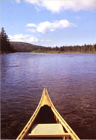
Canoe trips through the Allagash can last a week or more. Photo courtesy of Kevin Shields
Canoe trips through the Allagash can last a week or more. Photo courtesy of Kevin Shields |
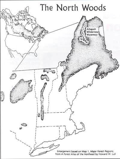
The crown jewel of Maine's North Woods and a scenic refuge without rival, the Allagash Wilderness Waterway (Allagash) is a protected 92-mile-Iong river, stream, lake, and pond corridor. It is the longest and most scenic national wilderness area east of the Mississippi (Allagash: Maine's Wild and Scenic River, 1994). The Allagash was established in 1966 by virtue of an act passed by the Maine State Legislature to preserve, protect, and enhance the scenic natural beauty and wilderness character of the area.
Along with Baxter State Park, the Allagash is one of only two areas in Maine designated to be managed as wilderness and was the first state-administered component of the National Wild and Scenic Rivers System-a designation given to only 2% of the rivers in the country (Losing Paradise: The Allagash Wilderness Waterway Under Attack, June 2000).
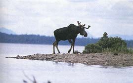
The name Allagash alone, in the minds of many, conjures up images of a wild, remote, and uninhabited area. The trip there is a never-to-be-forgotten experience. "The value of a trip is enhanced by the forests, wildlife, and unusual features encountered along the way: bald eagles nesting in towering eastern white pines; moose and deer feeding along the edges of the watercourse; ospreys soaring overhead; loons filling the evening air with their haunting cries..." The Allagash River watershed, which contains 22,840 acres of land, has long been recognized and enjoyed as a sportsmen's paradise and respite from urban life (Allagash Wilderness Waterway Management Plan, January 1999).
To maintain the wilderness character of the Allagash, Maine has sought to preserve and protect the natural character of the area by developing a state-owned Restricted Zone-an area averaging 500 feet in width along the entire length of the waterway which is to be managed by the Bureau of Parks and Land. For example, only canoes without motors may be used on Allagash Lake, while most of the Allagash is traversed by canoe with a motor no larger than 10 horsepower. Just two of the southern- most lakes are open to motorboats.
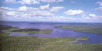 The Allagash watershed with the Katahdin range in the distance from the summit of Allagash Mountain. Photo courtesy of Dean B. Benett, author, Allagash: Maine's Wild and Scenic River |
The Allagash actually lies within a working forest. Thus, while timber harvesting is prohibited in the Restricted Zone, an extensive road system was developed by logging companies primarily to transport timber to mills. Along with this industry, the State Conservation Commission's concept of balanced development (i.e., recreational and commercial land use) inside the waterway has resulted in accessibility by many to a once primitive and remote area. Many now use the logging roads to gain access to the Allagash.
Further, public use data for the Allagash, considered one of the major primitive river courses in the United States, indicate an increase in the number of boaters and fishermen using the area for quick day trips (day trippers), thus denigrating the wilderness quality of the Allagash. In contrast, traditionalists (river guides, campers, and environmentalists) believe use of the area should be restricted to those engaging in week-long canoeing/ camping trips (through trippers) and are seeking the essence of the Allagash wilderness experience.
Writing for the Bangor Daily News (August 7, 1999), Susan Young stated, "There is no doubt that more roads run through the area and that more people come to use the river, but not everyone agrees that the waterway is being degraded or that its natural allure is being ruined" At the heart of the controversy is how much more, if any, access the state should allow. The attempt to please everyone has recently focused on boat launch areas-the state currently recognizes and maintains seven legal access points.
The Maine Bureau of Parks and Lands recently proposed a plan that would allow development of a new water access site near John's Bridge for both vehicular access and a boat launch facility for the purpose of hand-launching canoes. The site would include a parking area just outside the Allagash Restricted Zone, a loop road within the Restricted Zone to within 125 feet of the shore, and a six-foot-wide hardened gravel path from the road to the water.
The site is located near a small but very active wildlife corridor between Eagle and Churchill LakesEagle Lake, in particular, is a very remote and pristine part of the Allagash. In his book, Allagash: Maine's Wild and Scenic River, Dean Bennett describes the area as one where "cows and calves (moose) often feed along the shore. In summer the channel's deep, cold water attracts fish, which in turn invite loons and their young, ospreys, and bald eagles."
Environmentalists contend that any access at John's Bridge would draw more and more people and ultimately result in a negative impact on the wildlife inhabiting the area. Allagash Alliance President Dave Hubley ponders the issue: "There are 2,500 lakes in Maine-who really thinks we should treat the lakes that are part of the Allagash the same way we treat Sebago and Moosehead Lake (other previously remote areas that are experiencing extensive development)? Is it unfair to limit public access on 0.2 percent of Maine's lakes in the interest of retaining the wild nature of the area?" (Interview; June 28, 2000.) The proposed site has pitted local fishermen and day trippers who wish to access Eagle Lake against avid through trippers, river guides, camp owners, environmentalists, and wilderness advocates.
Because the site is new development, it is subject to the requirements of the Americans with Disabilities Act (ADA). The Maine Bureau of Parks and Lands proposes a 15-foot wide by 50-foot long parking area for individuals with disabilities to load/unload canoes, a 5 to 8% grade enabling wheelchair use along the 150 feet of shale footpath, one parking space for persons with disabilities, and an accessible vault privy. As a result of these requirements, the proposed site has spurred additional controversy and has gained state-wide and national attention because groups representing individuals with disabilities are in conflict-some favor accessibility, while others argue for wilderness preservation.
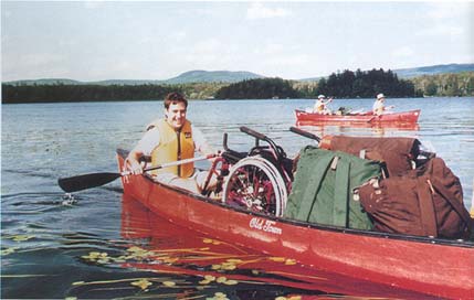 Wilderness Inquiry makes every effort to accommodate individuals with disabilities. Photographer Niobe Burden |
The controversy about John's Bridge began last year, when an individual with a mobility disability filed a complaint against the State of Maine, Department of Conservation. The complaint alleged that an access way should be developed at John's Bridge. However, the United States Department of the Interior opposed this view and ruled (November 23, 1999) that an accessible boat launch is available for individuals with disabilities at Churchill Dam-13.2 miles by car and 6.4 miles up stream by canoe from John's Bridge. Viewed in its entirety, the Department of the Interior ruled the Allagash meets requirements for access under Section 504 of the Rehabilitation Act of 1973 and Title II of the ADA.
Testimony related to accessibility and the John's Bridge site was again recently presented before Maine's Land Use Regulations Commission (LURC). LURC's mission is to identify recreation activities compatible with the wilderness and existing commercial uses within the 10.4 million acres of the North Woods of Maine-an area larger than Massachusetts, Connecticut, and Rhode Island combined.
At the LURC hearings, Peter Hilton, President of the Presque Isle Fish & Game Club, advocated for individuals with disabilities who wish to fish the area around Eagle Lake. Hilton recognizes the importance of the site for his grandson who has muscular dystrophy, a disease which denies the 14-year-old use of his legs, but who is quite capable of fishing once in a canoe. Hilton notes those who oppose John's Bridge "are convinced that their notions about the use of the waterway are the only ones that should prevail." Governor Angus S. King agrees with Hilton's view and has recently thrown his support behind the $61,000 boat launch project (The Boston Sunday Globe, June 4, 2000).
On the other hand, Cathy Johnson, Executive Director of the National Resources Council of Maine (NRCM), argues the issue of accessibility for individuals with disabilities pales in comparison to anglers' tendency for quick trips in and out of the area resulting in "damaging demands on a waterway intended for multi-day canoeing trips. In fact, Johnson believes the request for ADA access to the John's Bridge area is a thinly veiled effort to open the waterway to much heavier use by daytrippers who have no disabilities" (The Boston Sunday Globe,June 4, 2000).
Since this is the only long-distance wilderness canoe route protected in Maine, NRCM and other groups would like to close some of the existing waterway access points rather than expand them. Betty Grant, a guide for Wilderness Inquiry, an organization providing adventure trips to the Allagash for individuals with disabilities, added additional substance to the debate. She maintains that, "None of my clients ever asked for a six-foot wide trail or road to take them to the river. They are looking for activities that are more challenging than drive-to-fishing or a weenie roast in the park" (Bangor Daily News,June 29,2000).
 Allagash Wilderness Waterway in the north woods of northern Maine. Map courtesy of Dean B. Bennett, author, Allagash: Maine's Wild and Scenic River. |
As deliberations continue with the]ohn's Bridge proposal and with similar issues that will undoubtedly surface in the years ahead, the Federal Government, as well as Maine's LURC will surely struggle with the potential impact of each new request for recreational use of the Allagash. Questions that all of us must ultimately answer are--
Famed naturalist and author Henry David Thoreau paddled a part of the Allagash in July of 1857, making it as far north as Eagle Lake (The Maine Woods). His description of a wild area full of waterfalls, rapids, bears and moose helped to create the mystique that surrounds the Allagash today and hopefully in the future.
Bennett, D. (1994). Allagash: Maine's Wild and Scenic River.
Camden, Maine: Down East Books.
Bennette, S. and Bennette, D. (1994) Allagash Wilderness Waterway: A Natural
History Guide. Bureau of Parks and Recreation, Maine Department of Conservation.
Bureau of Parks and Lands. (1996). Allagash Wilderness Waterway. Maine
Department of Conservation.
Bureau of Parks and Lands. (1998, January 1). Outdoors in Maine. Maine
Department of Conservation.
Bureau of Parks and Lands. (1999, January). Allagash Wilderness Waterway
Management Plan. Maine Department of Conservation.
Bureau of Parks and Lands. (2000, February 1).State Sponsored and Assisted
Boat Access Sites. Maine Department of Conservation.
Gilpatrick, G. (1995). Allagash: The Story of Maine's Legendary Wilderness
Waterway. Skowhegan, Maine: Gil Gilpatrick.
Grant, B. (2000, May 18). Allagash Access. Bangor Daily News, www.bangornews.com
Hall, T. (1998, August 3). Letter to Terrance J. Winter. Bangor, Maine: Maine
Department of Conservation.
Higgins, A. (2000, June 4). Canoe launch divides environmentalists, disabled. The
Boston Sunday Globe, pp. C1 and C2. Land Use Regulation Commission. (1999,
February 5). Land Use Districts and Standards. Maine Department of
Conservation.
Lovaglio, R. (1999, April 20). Letter to Terrance J. Winter. Augusta, Maine:
Maine Department of Conservation.
Maine Land Use Regulation Commission. (1997). Comprehensive Land Use Plan.
Maine Department of Conservation.
Maine Public Employees for Environmental Responsibility. (2000, June).Losing
Paradise: The Allagash Wilderness Waterway Under Attack. Millinocket,
Maine.
Spriggs, D. (1999, November 23). Letter to Tom Morrison, Maine Department
of Conservation. Washington, DC: United States Department of the Interior.
Thoreau, H. (Published posthumously). The Maine Woods. New York, New
York: Penguin Books.
Webre, A. and Zeller J. (1990). Canoeing & Kayaking for Persons with Disabilities.
Springfield, Virginia: American Canoe Association.
Wilderness Inquiry. (1999). Integration Through Adventure. Minneapolis,
Minnesota.
Wilderness Inquiry. (2000-2001). Share the Adventure! Minneapolis,
Minnesota. .
Young, S. (1999, August 7). Allagash Waterway attracts tourists, conservationists,
loggers and trouble. Bangor Daily News, www.bangornews.com
Young, S. (2000, June 29). Advocates debate Allagash access. Bangor Daily
News, pp. H1 and B4.
Throughout the process of researching and information gathering for this article,
a number of experts were consulted about various aspects of the subject. This
author wishes to acknowledge the following for the sharing of their, time,
efforts, and materials-- all cited added to the quality of the article: Phyllis
Austin, Maine Times, Brunswick, Maine; Dean and Sheila Bennett, Mt.
Vernon, Maine; Tim Caverly, Director, Public Employees for Environmental Responsibility,
Millinocket, Maine; Betty Grant, Machiasport, Maine; Herb Hartman, Deputy Director,
Bureau of Parks and Lands, Augusta Maine; Peter Hilton, President, Prseque
Isle Fish and Game Club, Presque Isle, Maine; Dave Hubley, The Allagash Alliance
Group, West Buxton, Maine; Linda Koski, Allagash Canoe Trips, Greenville Maine;
Thomas Morrisson, Director, Bureau of Parks and Lands, Augusta, Maine; Corey
Schlosser-Hall, Outreach Director, Wilderness Inquiry, Minneapolis, Minnesota;
Kevin Shields Photographer, Dresden, Maine; Bill Silliker, Jr.,Wildlife & Nature
Photography, Ocean Park, Maine.
Acknowledgements
|