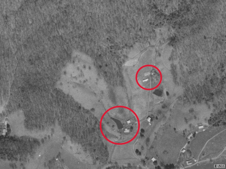
My grandmother grew up on a farm in the Waynesville area, near Ashville. It is on a hill known to the family as Scorpion Knob, but known officially as Poison Cove Top (near the center of this USGS map).
Following a fire, the family home was rebuilt and is shown in the large red circle in the south-central portion of the 1997 aerial photo shown below . The family property includes the entire cleared slope to the north and west of the pond. My uncle Oswald lived on an adjacent farm indicated by the smaller circle.
Back to my North Carolina page.